fleet.wikisort.org - Lighthouse
Duncansby Head (Scottish Gaelic: Ceann Dhunngain[3] or Dùn Gasbaith[4]) is the most northeasterly part of both the Scottish and British mainlands, slightly northeast of John o' Groats. It lies approximately 20 km (12 mi) east-southeast of Dunnet Head, the northernmost point of both the Scottish and British mainlands. Duncansby Head is located in Caithness, Highland, in north-eastern Scotland.[5] The headland juts into the North Sea, with the Pentland Firth to its north and west and the Moray Firth to its south.
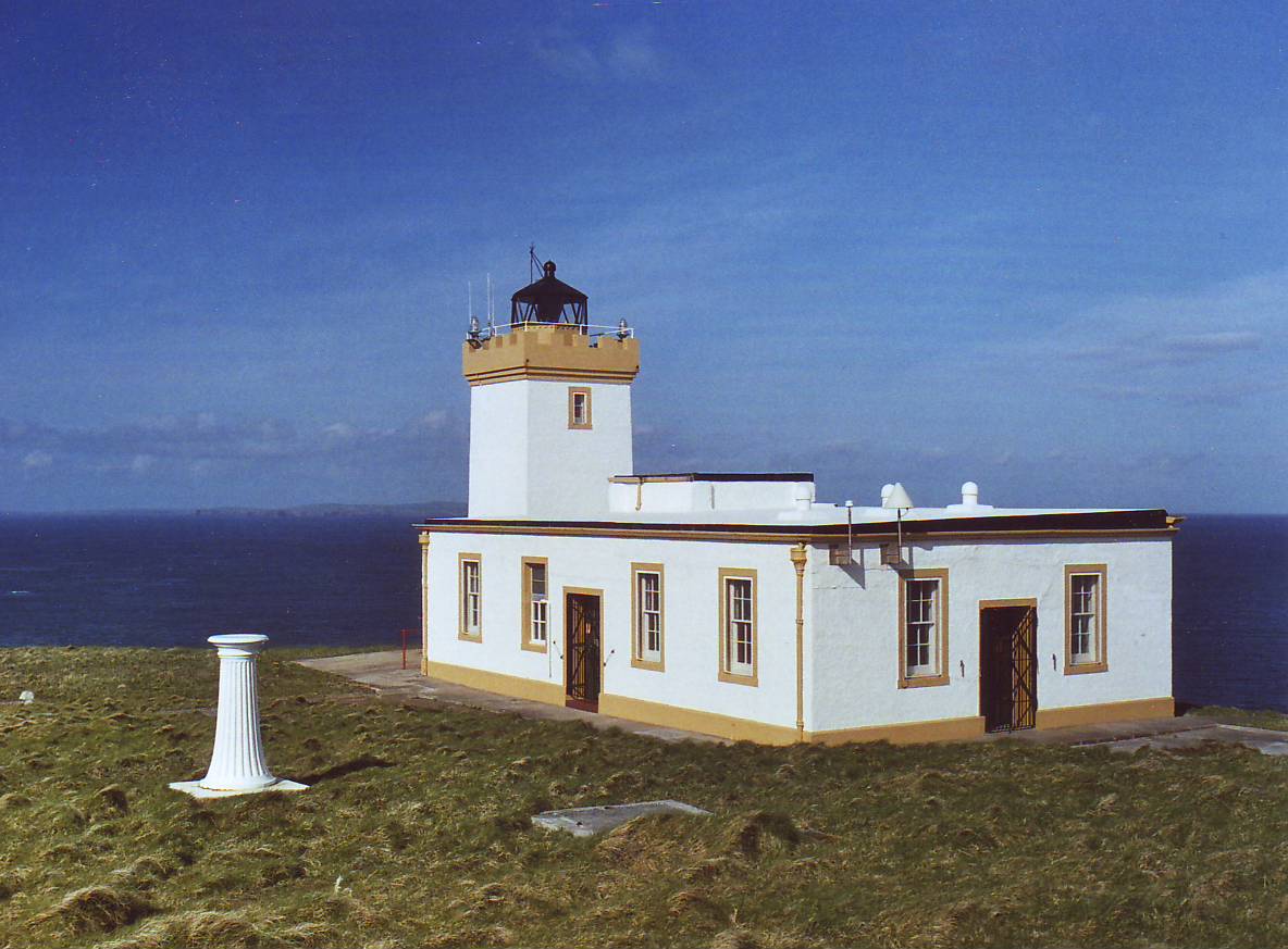 Duncansby Head Lighthouse | |
 | |
| Location | Duncansby Head Scotland United Kingdom |
|---|---|
| Coordinates | 58.644039°N 3.025120°W |
| Tower | |
| Constructed | 1924 |
| Designed by | David Alan Stevenson |
| Construction | concrete tower |
| Automated | 1997 |
| Height | 11 m (36 ft) |
| Shape | square tower with balcony and lantern |
| Markings | white tower, black lantern, ochre balcony |
| Power source | mains electricity |
| Operator | Northern Lighthouse Board[1][2] |
| Racon | T |
| Light | |
| Focal height | 67 m (220 ft) |
| Intensity | 596,000 cd |
| Range | 22 nmi (41 km) |
| Characteristic | Fl W 12 s |
Lighthouse
The point is marked by Duncansby Head Lighthouse, built by David Alan Stevenson in 1924.[6]
A minor public road leads from John o' Groats to Duncansby Head,[7] which makes Duncansby Head the farthest point by road from Land's End.
The Duncansby Head Site of Special Scientific Interest includes the 6.5-kilometre (4-mile) stretch of coast south to Skirza Head. It includes the Duncansby Stacks, prominent sea stacks just off the coast.[8]
Atomic Weapon Test
In 2016, it was reported in The Sunday Post newspaper that scientists from the Atomic Weapons Establishment in Aldemarston had proposed a nuclear weapon test on the Stacks of Duncansby in 1953, but that the prevailing wet weather was too much for contemporary electronics and the idea was shelved.[9]
See also
- List of lighthouses in Scotland
- List of Northern Lighthouse Board lighthouses
References
- Rowlett, Russ. "Lighthouses of Scotland: Highlands". The Lighthouse Directory. University of North Carolina at Chapel Hill. Retrieved 10 May 2016.
- Duncansby Head Northern Lighthouse Board. Retrieved 10 May 2016
- Gaelic and Norse in the Landscape: Placenames in Caithness and Sutherland Archived 2011-09-21 at the Wayback Machine. Scottish National Heritage.
- http://www.scottish.parliament.uk/Gaelic/placenamesC-E.pdf [bare URL PDF]
- Society of Antiquaries of Scotland (1862). Proceedings of the Society of Antiquaries of Scotland. Vol. 3. Neill and Company. p. 499.
- "Duncansby Head Lighthouse". The Museum of Scottish Lighthouses. Archived from the original on 27 July 2014. Retrieved 23 July 2014.
- "Scothighlands - How to drive to Duncansby Head from John O'Groats". www.scothighlands.com. Retrieved 31 October 2019.
- SSSI citation[permanent dead link]
- "Experts nearly dropped an atomic bomb on a Scottish landmark in the 1950s - Sunday Post". Sunday Post. 31 October 2016. Retrieved 8 November 2018.
External links
| Wikimedia Commons has media related to Duncansby Head. |

| Authority control |
|
|---|
This article about a Site of Special Scientific Interest in Scotland is a stub. You can help Wikipedia by expanding it. |
This Highland location article is a stub. You can help Wikipedia by expanding it. |
This British lighthouse-related article is a stub. You can help Wikipedia by expanding it. |
Другой контент может иметь иную лицензию. Перед использованием материалов сайта WikiSort.org внимательно изучите правила лицензирования конкретных элементов наполнения сайта.
WikiSort.org - проект по пересортировке и дополнению контента Википедии