fleet.wikisort.org - Lighthouse
Eilean Musdile (Mansedale) is an islet, and lighthouse to the south west of Lismore in the Inner Hebrides.
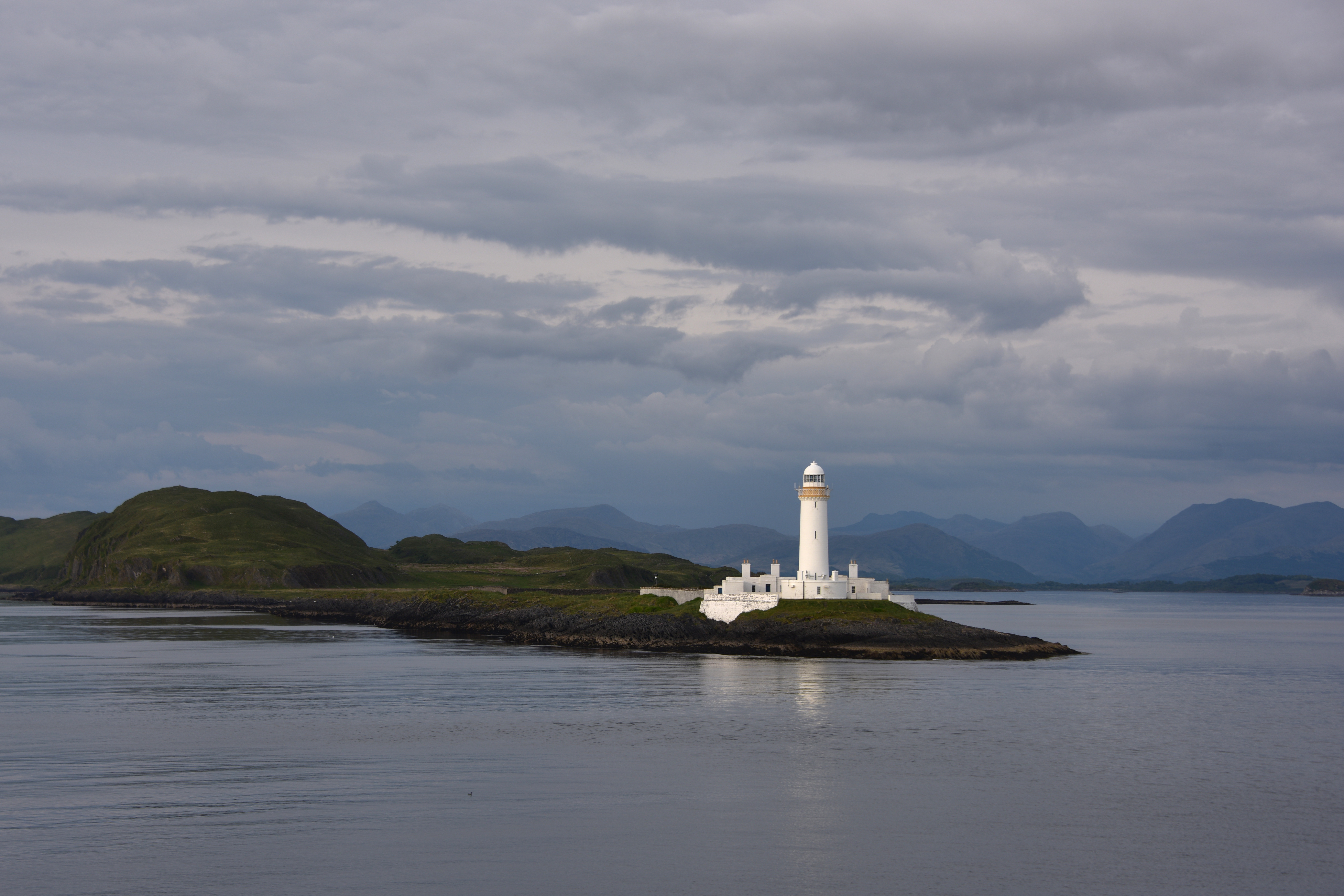 The lighthouse on Eilean Musdile from the Oban to Craignure ferry. | |
 | |
| Location | Eilean Musdile Firth of Lorn Scotland |
|---|---|
| OS grid | NM7781235105 |
| Coordinates | 56°27′20.1″N 5°36′26.6″W |
| Tower | |
| Constructed | 1833 |
| Designed by | Robert Stevenson |
| Construction | masonry tower |
| Automated | June 1965 |
| Height | 26 metres (85 ft) |
| Shape | cylindrical tower with balcony and lantern attached to 1-storey keeper's house |
| Markings | white tower and lantern, ochre trim |
| Operator | Northern Lighthouse Board[1][2] |
| Heritage | category A listed building |
| Light | |
| Focal height | 31 metres (102 ft) |
| Intensity | 71,000 candela |
| Range | 17 miles (27 km) |
| Characteristic | Fl W 10s. |
The island lies in the entrance to Loch Linnhe, separated from Lismore by a sound ¼ miles across.[3] It is a low-lying rock, ten acres (4.0 hectares) in size,[3] with some grass on it. CalMac ferries pass close to the island on their way from Oban to Mull.
The lighthouse was built by Robert Stevenson in 1833 at a cost of £4260[4] and initially showed a fixed white light.[3] In 1910 most of the Northern Lighthouse Board's lights were changed to dioptric or Fresnel lenses but Lismore and Fidra, in the Firth of Forth, were left as the only remaining purely catoptric lights in the service.[3]
A Standing Stone once stood on the highest point of the island (NM779351). The 9-foot (2.7 m) monolith appears to have recorded the midwinter sunset[clarification needed] and is thought to have been removed during construction of the lighthouse.[5]
The skerry of Lady's Rock lies a short distance to the south west.
See also
- List of lighthouses in Scotland
- List of Northern Lighthouse Board lighthouses
Footnotes
- Rowlett, Russ. "Lighthouses of Scotland: Argyll and Bute". The Lighthouse Directory. University of North Carolina at Chapel Hill. Retrieved 19 May 2016.
- Lismore Northern Lighthouse Board. Retrieved 19 May 2016
- "History of Lismore Lighthouse". Northern Lighthouse Board. Retrieved 1 November 2008.
- "Lismore Lighthouse". Gazetteer for Scotland. Retrieved 1 November 2008.
- "Eilean Musdile Standing Stone". The Northern Antiquarian. Retrieved 1 November 2008.
External links
| Authority control |
|
|---|
This Argyll and Bute location article is a stub. You can help Wikipedia by expanding it. |
This British lighthouse-related article is a stub. You can help Wikipedia by expanding it. |
На других языках
[de] Eilean Musdile
Eilean Musdile, auch Mousedale,[1] ist eine kleine, unbewohnte schottische Insel an der Grenze der Council Area Argyll and Bute. Es existieren zwei Anlegepunkte für Boote, sodass die Insel sowohl von Norden als auch aus südlicher Richtung angefahren werden kann.[2][3] 1794 wurde ein Menhir an der Südküste der Insel vermerkt. Der unbehauene Granitblock ragte von einer Grundfläche von 90 cm × 60 cm bis in eine Höhe von 2,75 m. Er ist heute nicht mehr vorhanden und wurde wahrscheinlich während des Leuchtturmbaus entfernt.[4]- [en] Eilean Musdile
Другой контент может иметь иную лицензию. Перед использованием материалов сайта WikiSort.org внимательно изучите правила лицензирования конкретных элементов наполнения сайта.
WikiSort.org - проект по пересортировке и дополнению контента Википедии