fleet.wikisort.org - Leuchtturm
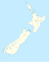
Baring Head Lighthouse ist ein Leuchtturm auf Baring Head in der Region Wellington auf der Nordinsel Neuseelands.[1] Er wird von Maritime New Zealand betrieben.
| Baring Head Lighthouse | ||
|---|---|---|
 | ||
| Ort: | Baring Head, Nordinsel, Neuseeland | |
| Lage: | Wellington, Neuseeland | |
| Geographische Lage: | 41° 24′ 28,9″ S, 174° 52′ 16,1″ O | |
| Höhe Turmbasis: | 87 m | |
| Feuerträgerhöhe: | 12,2 m | |
|
| ||
| Kennung: | Oc. W 15s (9s on, 6s off) | |
| Nenntragweite weiß: | 10 sm (18,5 km) | |
| Betriebsart: | 1989 automatisiert | |
| Funktion: | Leuchtturm | |
| Bauzeit: | 1935 | |
| Betriebszeit: | seit 1935 | |
Der Turm dient der Orientierung an der Cookstraße und der Zufahrt zum Wellington Harbour. Die achteckige Betonkonstruktion ersetzte 1935 einen Leuchtturm auf Pencarrow Head. Das Leuchtfeuer wurde anfangs von einem Dieselgenerator versorgt, aber bereits 1950 an das nationale Stromnetz angeschlossen. 1989 wurde der Leuchtturm automatisiert und wird seitdem wie alle Leuchttürme Neuseelands aus einem Kontrollraum von Maritime New Zealand in Wellington ferngesteuert.[1]
Einzelnachweise
- Baring Head. Maritime New Zealand, abgerufen am 18. Oktober 2018 (englisch).
На других языках
- [de] Baring Head Lighthouse
[en] Baring Head Lighthouse
Baring Head Lighthouse is a concrete lighthouse at Baring Head in the Wellington Region of the North Island of New Zealand, with an LED beacon powered by mains electricity.[2] It is owned and operated by Maritime New Zealand, and can be accessed via walking tracks in the southern area of the East Harbour Regional Park, south of Wainuiomata.Текст в блоке "Читать" взят с сайта "Википедия" и доступен по лицензии Creative Commons Attribution-ShareAlike; в отдельных случаях могут действовать дополнительные условия.
Другой контент может иметь иную лицензию. Перед использованием материалов сайта WikiSort.org внимательно изучите правила лицензирования конкретных элементов наполнения сайта.
Другой контент может иметь иную лицензию. Перед использованием материалов сайта WikiSort.org внимательно изучите правила лицензирования конкретных элементов наполнения сайта.
2019-2025
WikiSort.org - проект по пересортировке и дополнению контента Википедии
WikiSort.org - проект по пересортировке и дополнению контента Википедии
